
AVO II: The "Total Monitoring" challenge beneath the city

The story of the Américo Vespucio ring road began six decades ago with the vision of creating a nearly 65-kilometer road loop around the urban area of Santiago. Today, the capital's growth demands the completion of this monumental project with its final and most challenging section: Américo Vespucio Oriente 2 (AVO II).
This 5.2-kilometer fully underground section will connect the districts of Ñuñoa, Macul, La Reina, and Peñalolén. By dividing the eastern section into AVO I and AVO II, the latter will allow for travel between Príncipe de Gales and Los Presidentes in just five minutes via two one-way tunnels. Beyond the impact on commute times and heavy vehicle traffic underground, a 71,000-square-meter park and 7 kilometers of bike paths will be developed on the surface, promoting sustainable mobility. This highway is expected to be operational during the second half of 2028.
Underground complexity and the role of Geosinergia
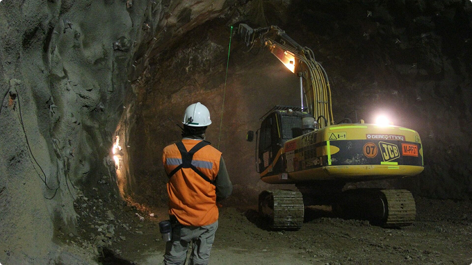
Building tunnels of this magnitude beneath an active city presents critical challenges. One of the greatest hurdles for AVO II is that its route passes beneath Line 4 of the Santiago Metro and involves large-section excavations. To ensure safety in this scenario, ground control must be absolute.
In a recent television interview, Enrique Díaz explained how Geosinergia addresses this challenge through what he defines as "Total Monitoring".
This concept involves deploying all types of measurements: high-precision topography, optical solutions with manual measurements, and real-time geotechnical technology. Geosinergia's scope on AVO II is not limited to the interior of the tunnels; sensors constantly measure deformations and vibrations in buildings adjacent to the excavations as well as directly on the Line 4 Metro tracks, thereby protecting the area surrounding the project.
Technology in sight: Real-time control
To ensure all project stakeholders can visualize this immense volume of data, Geosinergia uses an advanced online platform.
One of the features of our T4G Platform is that it allows us to visualize the project layout directly, and on it, we can observe and analyze the progress of the underground excavations. On the project layout, we see various symbols and colors that indicate the instruments installed in the field.
By interacting with the platform, engineers can access relevant information, such as the location where a specific sensor is installed and, most importantly, through updated deformation charts, understanding the loads, movements, and stresses that construction progress exerts on a specific section. These charts are vital, as they show lines representing permissible limits:
- Preventive Alert Thresholds.
- Critical Thresholds.
Thanks to this system, we can verify that all current measurements of vertical settlement and deformation at AVO II are under strict control and within safe parameters.
📊 Learn more about our T4G monitoring platform, the technology behind this visual and online control: https://www.geosinergia.com/t4g
We invite you to watch and learn more about this topic in the following clip from the interview!
If you want to know all the details of this impressive road project, don't miss the full episode here:




Belo Horizonte, Minas Gerais

